- Screen Reader Access
- Skip to : main content / navigation
-
- Text Size
- Home
- Sitemap
- Contact us
- हिंदी


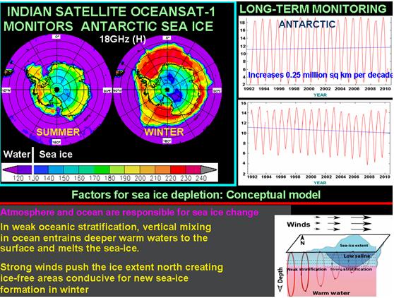
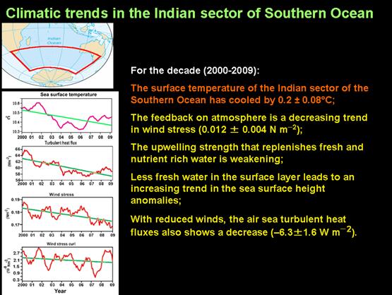
Monitoring of polar sea ice using high-resolution satellite data Satellite applications to Southern Ocean Synergistic use of satellite microwave sensors & ground Survey (GPS) data to construct an accurate Digital Elevation Models
State-of-art software (IDL7, ENVI & SCARSCAPE, ARCGIS) for satellite data processing
 |
 |
 |
|
 |
|

